WalkAbout Home
Welcome To WalkAbout
This is an old website being rejuvenated and updated. It is Dedicated to Initiating and/or Enhancing Understanding & Appreciation for Southern Illinois' Unheralded Natural Uniqueness.
Many links are provided to help one find ways to become active in Wild and Natural Area preservation and/or wildlife protection efforts locally and/or globally. A Work Forever In Progress - You Can Watch the Most Complete Southern Illinois Specific Set of Flora & Fauna Checklists Develop Right Before Your Eyes!
Southern Illinois, in our context, includes Jackson, Williamson, Saline, Gallatin, Union, Johnson, Pope, Hardin, Alexander, Pulaski, and Massac counties. The Shawnee National Forest (SNF) occupies significant acreage in each of these counties.
CONSIDER THIS PAGE AN APPETIZER IF YOU WILL
~ Creation of the Shawnee NATIONAL Forest ~
To the south the ancient Cache River Basin has presence in, from east to west, Pope, Massac, Johnson, Pulaski, Union, and Alexander counties.
Southern Illinois' Sparta Shelf consists, generally speaking, of limestone bluffs and hills along the Mississippi, graduating to sandstone counterparts as its backward J-shaped southerneastern tail courses somewhat concentric with the Ohio River.
North and east of or directly overlaying the shelf are the Ozark Foothills (Uplift) and the Shawnee Hills. West and south of the Sparta Shelf the landmass drops precipitously and considerably in elevation, flattens and becomes predominantly bottomlands of the Coastal Plains region. Near the Mississippi River Inspiration Point, in the LaRue-Pine Hills area, (near Wolf Lake) and about fifty miles to the east at Trigg Observation Point (near Simpson and the National Historic Register's archeological site, Millstone Bluff) one can both observe and feel where the extreme southernmost reaches of Illinois appear to dramatically drop out of sight. Bracing one's stance, in an ever-present gale, one is overcome with this "I can't be in Illinois" sensation when standing panoramically awestruck on a bluffs stony edge.
A COMMON VIEW AND A SHARED APPRECIATION
On July 6, 2005 I gained unsolicited insight into something I had long wondered. "How does Southern Illinois' GARDEN OF THE GODS WILDERNESS compare in beauty and grandeur with that of Colorado's Garden of the Gods?"
Standing atop one magnificent rock formation I heard these words echoing from another towering sandstone sculpture, one created by nature's eonic artful forces. "You know, this Garden of the Gods is even more beautiful than the Garden of the Gods in Colorado!"
Curious, I made it a point to approach the two men who obviously agreed on the superior grandeur of Southern Illinois' most visited natural wonder.
Dave Fearday and Dennis Alexander, from the Effingham Illinois area, were happy to honor my request that I convey their appreciation for Southern Illinois' Garden of the Gods. Both men said they had visited Colorado's version of our giant rock garden. Their enthusiasm for the beauty and great geological diversity of Southern Illinois was apparent. I hope you will too, if you have not already, develop a great understanding of and appreciation for some of nature's most fascinating displays, tucked away among our diverse forests and rugged terrain... right here in our own backyard.
Of International Interest
Few places offer so striking geological and biological contrasts in such a relatively small region.
The Cache River Basin includes the Cypress Creek National Wildlife Area and the Cache River Wetland, a "Wetland of International Importance", as designated by the United Nations Educational, Scientific, and Cultural Organization (UNESCO)during the Ramsar Convention on January 11, 1994.
The State of Illinois' official dedication: May 4th 1996.
Cache River and Cypress Creek Wetlands: Illinois 24,281 ha 59,999 ac
Coordinates: 37°18'N 089°02'W
Number of Contracting Parties: 170
Number of Ramsar Sites: 2,341
Total surface of designated sites: 252,479,417 ha (623,890,226.5 ac)
The United States of America currently has 39 sites designated as Wetlands of International Importance (Ramsar Sites), with a surface area of 1,861,603 hectares.
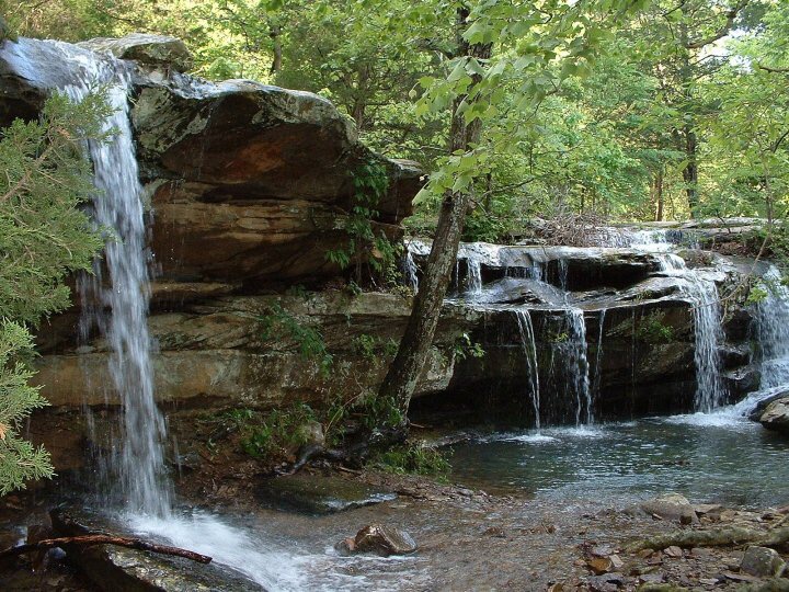
Burden Falls Wilderness Area
All photos and videos (shown or linked) on this website are by Duane Short unless otherwise credited.
Heron Pond Component of the Cache River State Natural Area >>>>>>>
SIELBECK FOREST STATE NATURAL AREA: CONSERVATION MATTERS
Thanks belongs to Ruth and the late Louie Sielbeck who ensured it would be protected in perpetuity. Nothing has been more gratifying to me than to work in conservation and the protection of our natural world. One of my most gratifying experiences in this area has been to directly hand plant about 30,000 of the 50,000 trees planted to expand, buffer, protect and enrich the biodiversity of Sielbeck Forest State Natural Area. Among the types of trees planted were cypress, maple, oak, poplular, ash, hickory, sweetgum and many others native to this region.
See Cypress Creek National Wildlife Refuge
Cache River is Home to National Natural Landmarks Heron Pond, Little Black Slough, and Lower Cache River Swamp.
Explore this informative publication about the Cache River Basin.
